Looking for alternatives to the DJI Fly app for better drone control?
While DJI and other drone manufacturers have their native flight control apps, they may not provide all the features you need.
Fortunately, there are several alternatives available that offer advanced functionalities and enhance your drone flying experience.
In this article, we will explore eight DJI Fly app alternatives that provide features like flight planning, pre and post-flight checks, automated flights, and more.
These apps include UAV Forecast, Sun Surveyor, DroneDeploy, Pix4D, and Litchi. Whether you are a professional drone pilot or an enthusiast, these alternatives can cater to your specific needs.
Before we delve into the alternatives, it’s worth mentioning that having drone insurance is essential for responsible flying. SkyWatch offers comprehensive liability and hull coverage with hourly, monthly, and annual plans.
Now, let’s explore some of the best alternatives to the DJI Fly app and discover their unique features.
Best DJI Fly App Alternatives
1. Litchi
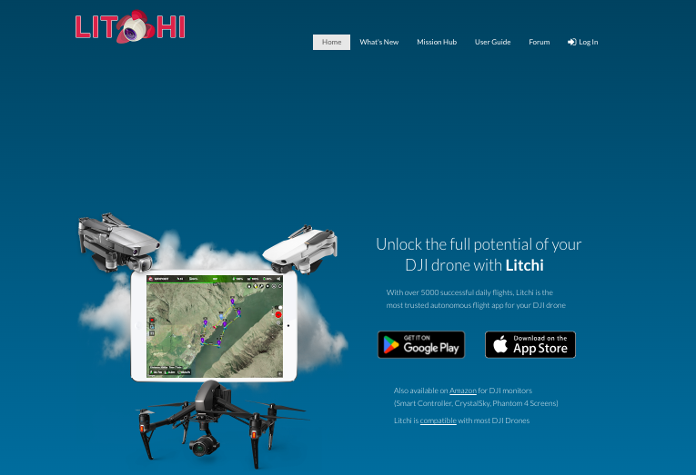
Litchi is a sophisticated autonomous flight app designed for DJI drones, providing a range of features not available in the standard DJI flight apps.
It enables drone pilots to create automated missions using waypoints, intelligent flight modes, and more. The app is compatible with a wide array of DJI drone models including the Mavic 2 series, Inspire 2, and Phantom 4 Pro, among others.
Available for both Android and iOS devices, Litchi is touted for enhancing the user experience, offering features like a powerful waypoint mission engine that is both intuitive and suitable for professionals and beginners.
It also allows for seamless mission syncing across all devices, including PC and Mac, which facilitates pre-planning of flights from a desktop environment.
Litchi stands out for its reliability, with over 5000 successful daily flights reported, and it’s available on Amazon for DJI monitors as well.
It supports a variety of intelligent flight modes and allows users to easily shoot horizontal, vertical, and 360 spherical panoramas, further showcasing its commitment to providing comprehensive drone flight management.
2. UAV Forecast

When it comes to drone flights, staying informed about current weather conditions is crucial for a safe and successful operation. That’s where UAV Forecast comes in.
This app provides up-to-date and accurate weather information specifically tailored for drone pilots, empowering you to make informed decisions before taking flight.
One of the main features of UAV Forecast is its ability to provide detailed wind speed and gust direction forecasts. By knowing the wind conditions, you can determine whether it’s safe to fly your drone and adjust your flight plan accordingly.
Additionally, the app offers information on rain probability, cloud cover, visibility, and temperature, allowing you to assess the overall weather conditions at your location.
UAV Forecast goes beyond weather updates and also alerts you to no-fly zones and flight restrictions, ensuring that you comply with regulatory guidelines and avoid any potential legal issues.
The app is available for both iOS and Android devices, making it accessible to a wide range of drone pilots.
Key Features
- Accurate wind speed and gust direction forecasts
- Information on rain probability, cloud cover, visibility, and temperature
- Alerts for no-fly zones and flight restrictions
- Compatible with iOS and Android devices
With UAV Forecast, you can confidently plan your drone flights, knowing you have the most up-to-date weather information at your fingertips.
Whether you’re a professional drone operator or an enthusiast looking to capture stunning aerial shots, this app is an essential tool for ensuring a safe and successful flight experience.
3. Sun Surveyor

When it comes to capturing breathtaking aerial photographs, timing is everything. That’s where Sun Surveyor comes in.
This powerful pre-flight planning app provides photographers and drone enthusiasts with real-time information on the movement of the sun and moon during sunrise, sunset, and moon phases.
With Sun Surveyor, you can accurately predict the position of the sun and moon at any given location and time, helping you plan your shots and anticipate how shadows will cast in specific areas.
Not only does Sun Surveyor offer precise sun and moon data, but it also provides a range of useful features.
The app includes augmented reality (AR) view, which overlays the sun and moon paths onto live camera images, allowing you to visualize the exact location of the sun and moon in your surroundings.
Additionally, Sun Surveyor offers a map view, showing you the path of the sun and moon over a map, and a 3D compass view, allowing you to see the azimuth, elevation, and distance of the sun and moon in relation to your current position.
Key Features
- Real-time sun and moon positions
- AR view for visualizing sun and moon paths
- Map view for tracking the path of the sun and moon
- 3D compass view for precise azimuth and elevation information
- Moon phase calendar
- Golden hour and blue hour times
Whether you’re a professional photographer planning a sunrise shoot or a drone pilot scouting the perfect time to capture stunning aerial footage, Sun Surveyor is your go-to app for accurate and detailed sun and moon information.
With its intuitive interface and robust features, this pre-flight planning app is a must-have tool in your photography and drone toolkit.
Next, we’ll explore two other DJI Fly app alternatives, DroneDeploy and Pix4D, which offer advanced photogrammetry and mapping capabilities.
4. DroneDeploy and Pix4D

When it comes to photogrammetry and mapping, DroneDeploy and Pix4D are two of the leading services in the industry.
These powerful tools allow you to fly automated missions and capture high-quality imagery for creating topographic maps and 3D models.
Whether you are a professional surveyor or a hobbyist looking to explore the world of aerial mapping, DroneDeploy and Pix4D have got you covered.
One of the key features offered by DroneDeploy is its user-friendly interface, making it accessible for both beginners and experienced users.
The app allows you to plan your flight missions, set waypoints, and even program autonomous flights. With advanced imaging capabilities, you can capture detailed visuals and collect data for analysis.
Pix4D, on the other hand, offers a comprehensive suite of tools for 3D mapping and modeling. By leveraging advanced photogrammetry techniques, Pix4D can process the imagery captured by your drone and transform it into accurate and detailed 3D models.
Additionally, Pix4D offers features like thermal imagery, which can be particularly useful for industries such as agriculture and construction.
Benefits of using DroneDeploy and Pix4D
- Automated flight missions for efficient data collection
- High-quality imagery for accurate mapping and modeling
- User-friendly interfaces for easy navigation and operation
- Advanced features like thermal imagery for specialized applications
- Compatibility with a wide range of drones for versatility
Both DroneDeploy and Pix4D offer free versions of their apps, allowing you to explore their basic features and functionality. However, for access to more advanced capabilities, paid plans are available.
These paid plans provide additional tools and features to enhance your mapping experience and cater to the specific needs of professionals in various industries.
Conclusion
After considering various DJI Fly app alternatives, one standout choice is Litchi. It offers a comprehensive set of features that make it an excellent alternative for DJI drone users.
With Litchi, you can enjoy advanced imaging capabilities, waypoint missions, and autonomous flight modes.
One of the main reasons for choosing Litchi as the best DJI Fly app alternative is its compatibility with DJI’s Smart Controller.
This ensures seamless integration and enhances the overall user experience. Additionally, Litchi has garnered positive reviews from users, further solidifying its position as a top choice.
Whether you’re looking for precise flight planning, automated flights, or advanced imaging features, Litchi has it all.
For a one-time cost of $24.99, you can unlock the full potential of your DJI drone with Litchi’s extensive feature set.